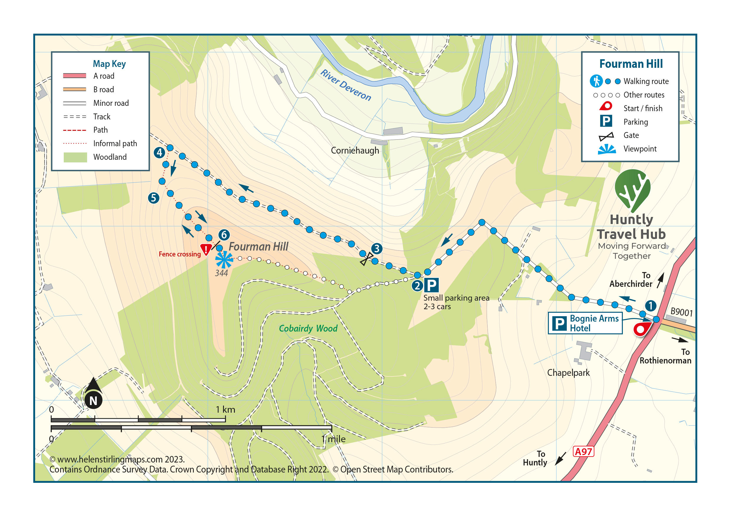
Start at the Bognie Arms (1) and walk up the road to the right of the building for 2km. Alternatively, you can drive up this road. There is a small parking area for 2-3 cars at end of the tarmac road at the north-eastern end of Fourman Hill. (2)
Head down the broad grassy track that contours around the north of Fourman Hill, go through the gate (3) and continue along this track for around 1km.
Turn left up an informal track (4) heading up the hill just before you reach another gate (5) on the north west side of the Hill. Follow this track keeping a fence on your right until reaching a small fence. (6) Climb over this fence and head up right on a small path to the trig point.
Return the same way.
Route Summary
One of the best landmarks north-east of Huntly, with spectacular views in every direction. Following part of a historic road that The Mary Queen of Scots once travelled on.
Difficulty
Moderate: Trails with some steeper sections; earth, grass or stone paths with some uneven surfaces.
Distance
7 km / 4.4 miles
Walking Time
1.5 hours