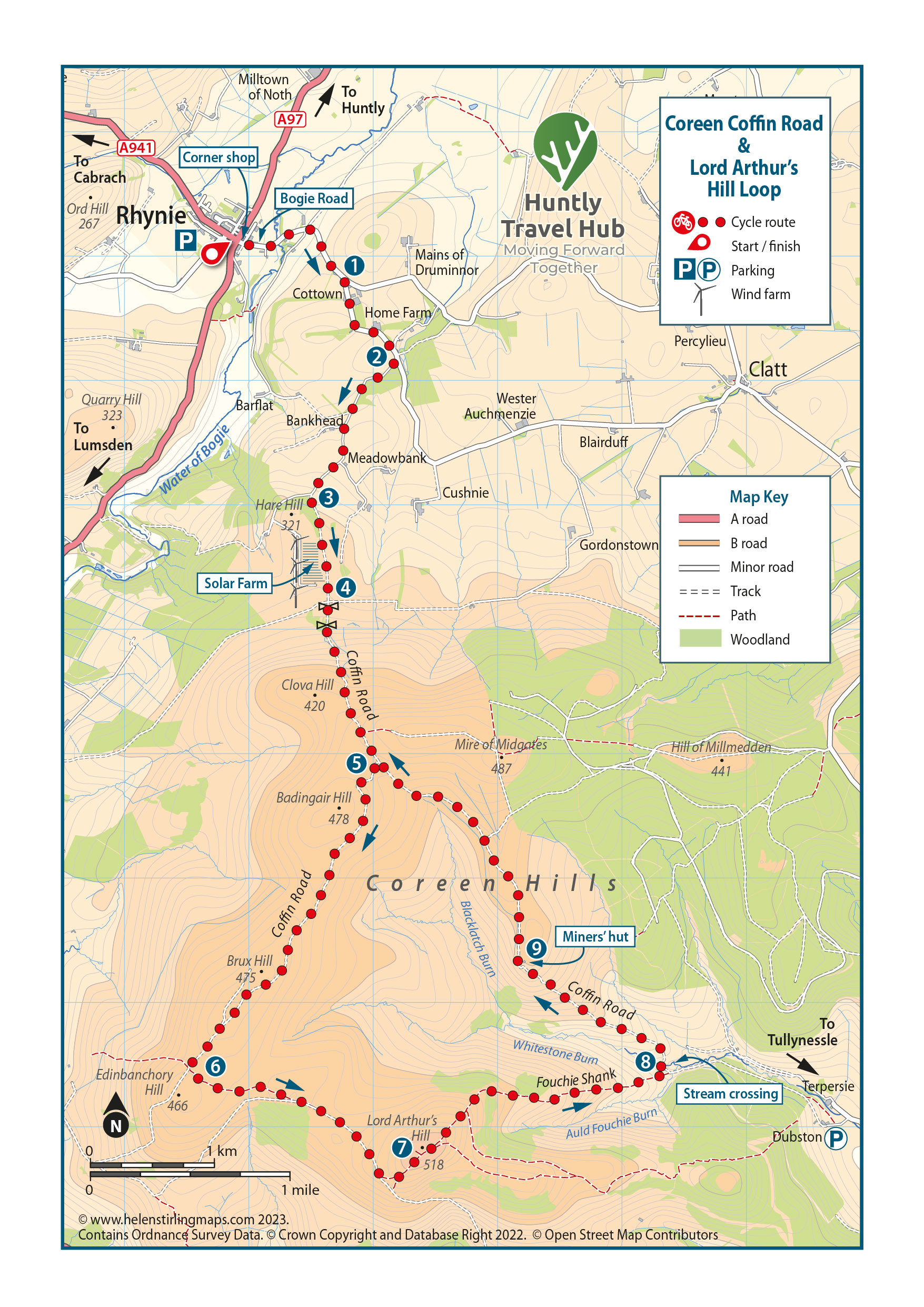
From Rhynie head down Bogie Road (next to the corner shop) for 1km and turn right on the road signed to Kennethmont and Clatt. (1) Follow this road for 800m and take the next turning on the right, (2) up a small road, and follow this uphill.
When you reach the plantation, just before the wind turbines, turn left onto a grassy track. (3) Follow this track, with the solar farm on your right, until you reach a gate with a signpost to Tullynessle and Clatt. (4)
Go straight through the field (warning: there may be cows) and through the next gate into the trees and onto the old coffin road leading up onto Clova Hill. Head up the hill following the coffin road for 1km then take the first track on the right after the fence (this bit can be boggy). (5) Follow this track, passing Badingair and Brux Hill, and turn left once reaching Edinbachory Hill. (6) You should be able to see Lord Arthur’s Hill. Continue around the right-hand side of the hill until you reach the track to the left taking you to the summit. (7)
Enjoy the fast grassy descent down the Fouchie Shank. Take the track to the left at the bottom, with a stream crossing, (8) and head up the track. You are now back on the coffin road which will take you past an old quarry with a wee miners' hut, (9) and back over to Clova Hill. Head back to Rhynie the same way once through the signposted gate.
Route Summary
A circular route, that takes in the highest point of the Coreen Hills and an old coffin road, connecting Rhynie to Tullynessle.
Difficulty
Hard / strenuous: Trails with challenging climbs, tricky descents and technical features. Suitable for proficient mountain bikers with good off road skills and fitness.
Distance
22 km / 13.6 miles
Cycling Time
3 hours